C-SRNWP

paysage-eumetnet

44th EWGLAM & 29th SRNWP workshop

0 Comments

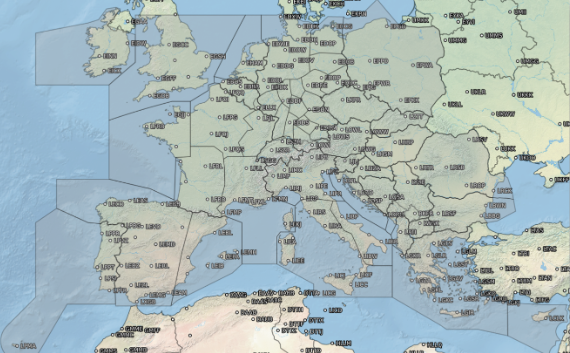
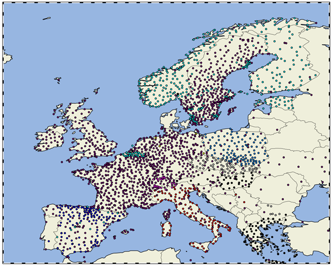
The 44th European Working Group on Limited-Area Modelling (EWGLAM) Meeting and the 29th Short Range NWP (SRNWP) Meeting were successfully organized between 26-29 September in Brussels, Belgium, with around 80 in-situ and 60 online participants and several invited speakers. The special topic this year was “Opportunities and challenges in hectometric NWP”. It was concluded that many hectometric NWP applications nowadays are focusing on urban environment. The most important challenges related to these models are adequate external parameters (e.g. land use database on the order of 10 m) and suitable physical parameterizations (e.g. 3D turbulence). A special session was also organized about the future evolution of High Performance Computing.

Presentations are available at the meeting’s website: http://srnwp.met.hu/Annual_Meetings/2022/index.html

EMMA

0 Comments

EMMA

Objectives

EMMA (European Multi service Meteorological Awareness) and the Meteoalarm web page represent one of the most successful and visible achievements of EUMETNET. EMMA has improved national and European multi-hazard warning systems over the last decade by developing standards, and has deepened the cooperation with partners like civil protection, the DRR community and the water sector. Meteoalarm has been operational since 2007 and the website has generated large public interest.

The objectives of EMMA are:

  • To show the most relevant information on Meteoalarm needed to prepare for extreme weather and related hazards expected to occur somewhere over Europe.
  • Provision of warnings understandable by all actors from the private and public sector. Warnings are multilingual and harmonized as far as possible, whereas the four level color code is seen as understandable “language“.
  • The Meteoalarm web page provides a one-stop shop and a repository for multi-hazard warnings.
  • Research and Development: harmonization of the warnings towards impact oriented warnings.
  • Support of the regional cross-border collaboration between forecasters.
  • Networking and coordination with relevant organizations like Civil Protection Organizations and ERCC the Emergency Response and Coordination Centre of the European Commission
  • EMMA provides the basis for knowledge transfer to other regions and the service delivery improvement of developing weather services.
  • “We travel more frequently, either on business or privately, and the exposure to risks abroad is greater than at home. Meteoalarm integrates all important severe weather information over Europe originating from the official National Public Weather Services across all participating European countries - ensuring that information is presented consistently to allow for coherent interpretation as widely as possible, with easy accessibility across languages and culture.”

The tasks

Collection and online publication of the authoritative warning information for meteorological and hydrological hazards delivered by 37 (as of 2018) National Meteorological and Hydrological Services (NMHSs) in 33 languages across the European domain for the next 48 hours.

Consistent presentation of the information to ensure coherent interpretation as widely as possible throughout Europe.

Technical quality control of the incoming messages and display of this information on maps with European, national and regional levels.

Operation of Meteoalarm as one-stop shop and a repository for relevant multi-hazard warnings to be used e.g. by professionals or tourists on a European scale. Re-user are able to acquire warning data from RSS and CAP (Common Alert Protocol) feeds or alternatively the alert hub.

Harmonization of the warnings as much as national procedures allow any adaptation with thresholds based on climatologically chosen regions and impact considerations.

Provision of a platform for meteorologists and hydrologists to discuss a consistent and harmonized system of warnings across Europe.

Comprehensive relaunch of Meteoalarm. The modernization and redesign of the whole system with improved functionality will give Meteoalarm a contemporary professional on-line presence, thus enhance the visibility of EUMETNET and the participating members and improve the accessibility of their authoritative warnings.


The organisation

The current phase of EMMA started in January 2019 and will last until the end of 2023. The Coordinating Member is ZAMG (Austria). The Programme Manager is Rainer Kaltenberger. The EMMA Team is advised by the Meteoalarm Expert Group

For questions about EMMA please contact meteoalarm@zamg.ac.at

Further Information

For further information, please go to the MeteoAlarm web page.

EPS II

0 Comments

EPS II

Objectives

The main aim of the Project is to contribute to build very high-resolution ensemble systems in Europe, resolving the convection-permitting scale phenomena.

The main objectives are to:

A. Develop new products and methodologies for calibration of LAM ensembles for extremes and probabilistic prediction of thunderstorms and fog:

1) Inventory of existing methods and SW already developed by the Members and literature review;

2) Define and develop new products and methodologies for computation/elaboration:

· calibration of ensembles, mainly for extremes (wind, precipitation, temperature,…);

· products for probabilistic prediction of thunderstorms (clear benefit, link with research, link with EMMA), fog.

B. Understanding the sensitivity of ensemble prediction systems to soil conditions and PBL and their effect on the prediction of selected phenomena (fog and thunderstorms)

1)      Investigating sensitivity of models to soil moisture and PBL;

2) Investigating the ratio of sensitivity to different sources of surface and upper air uncertainty at the CP scale.

  • "verbatim to complete"

The tasks

The project workload is divided into several work packages and then into tasks.

The complete list of tasks can be found here.


The requirements

The content of the requirements for the EUMETNET SRNWP-EPS Phase II (EPS-II) has a main aim: to contribute to build very high-resolution ensemble systems in Europe, resolving the convection-permitting scale phenomena. To reach this aim, the usual coordination within C-SRNWP was not enough, since dedicated meetings should be organized, where status and plans of the participants are revised and where an agreement on the ground for cooperation should be found.

The main open issues for scientific research on this subject are outlined and described in the document: “Explore the scientific methodologies suitable to build a very high-resolution ensemble” which is the Delivery 3 of the Phase I SRNWP-EPS Activity; the document was prepared by the Expert Team on EPS of the EUMETNET C-SRNWP Program. The aim of this document is to provide scientific and methodological basis for planning future work on the field; it includes a scope of topics larger than those covered by the phase II requirements. 

These requirements will help to identify few tasks which can be accomplished within a limited amount of time and with a dedicated amount of resources, leading to clear and tangible outcomes such as coexistence of both operational and (focused) research activities, in order to satisfy the different needs of the NMSs. Therefore, the topics which have been identified for this Phase II requirements focus on all-the-steps-towards-the-development of a methodology for the probabilistic prediction of severe weather phenomena (e.g. thunderstorms and fog), relevant for the operational duties of the NMSs.

The organisation

Institution Role Key Personnel  
Agencia Estatal de Meteorología – AEMET – Spain Project Manager Jose A. Garcia-Moya Funded
ARPA-SIMC Scientific Coordinator Chiara Marsigli Funded
USAM/CNCMA National Coordinator for Italy Francesca Marcucci In-kind
Expert Team Informing the Project Manager about strategic developments in Europe in the field of Ensemble Prediction System and probabilistic forecast Chair-person: Scientific coordinator
User’s Group Consultancy about the Application Tasks developments and their use in an operational environment Chair-person: Scientific coordinator


The Project currently has 21 Member NMSs participating. The complete list of participating Members can be found here.

The Project is coordinated by the Project Manager (PM) with the help of the Scientific Coordinator, to ensure a proper coordination between the Application and the Research Tasks, and the National coordinator for Italy, to ensure internal coordination between USAM/CNMCA and ARPA-SIMC.  The main advisory body is the Expert Team (ET)[1]. All together are responsible for overviewing the progress in the WP’s.


The main duties of the Project Manager are:

·       Ensure development of the Project and the fulfilment of all Deliverables and Milestones

·       Coordination with the Scientific Coordinator to guarantee the proper coordination between Application and Research Tasks

·       Reporting to and coordinating with EUMETNET STAC and Secretariat and the FPM (Forecasting Project Manager).

·       Liaising with C-SRNWP and other EUMETNET Programs.

·       Liaising with Programmes beyond EU such as WMO WG for Ensemble Prediction System and TIGGE-LAM

·       Supervising the organization of the meetings and liaising with the personnel working in the project to ensure smooth development

·       Participating in all the meetings and WebEx conferences organized in the framework of the Project, EUMETNET core team meeting and some of the FP meeting.

·       Coordination with the Eumetcal Project in order to organize possible calls from Eumetcal for participation in training activities about probabilistic forecast and ensemble prediction systems.

·       Coordination with SESAR project to exchange experiences in the field of use of probabilistic forecasts for Aviation and Airport activities.

The main duties of the Scientific Coordinator are:

·       Ensure that the Project follows the state-of-the-art of Ensemble Prediction System and probabilistic forecast

·       Supervising the scientific goals and methodologies of the Project Tasks

·       Coordinate with the personnel involved in the Application and Research Tasks

·       Reviewing the Deliverables of the Projects

·       Coordinate with the C-SRNWP Expert Team on Predictability and EPS

·       Liaising with ECWMF Research Department, WMO WG for Ensemble Prediction System, TIGGE-LAM

·       Help in supervising the organization of the meetings and liaising with project teams to ensure smooth development

·       Participating in all the meetings and WebEx conferences organized in the framework of the Project

The main duties of the National coordinator for Italy are:

·       Ensure internal coordination between USAM/CNMCA and ARPA-SIMC

·       Coordination with other Italian institution interested in probabilistic weather forecast

The main duties of the Expert Team are:

·       Informing the Project Manager about strategic developments in Europe in the field of Ensemble Prediction System and probabilistic forecast.

·       Attending the Expert Team meetings and delivering relevant information and documents required for the elaboration and completion of the deliverables of the Project.

The ET will be formed by one representative for each participating NMS, which will act as contact point between the coordinators and the NMSs. The C-SRNWP ET-EPS will be contacted to advice the project acting as part of the Expert Team on a voluntary basis for NMSs which are not participating in the project. Communication between the ET members will be guaranteed through an annual meeting (organized through the planned workshops and conferences) and additional WebEx Meetings where necessary. Reports of the meetings will be circulated to members.


The main duties of the participating NMSs are:

·       Nominate a contact point as a member of the Expert Team

·       Providing in-kind contribution for the Research Tasks

·       Providing in-kind contribution by attending meetings and delivering relevant information and documents required for the elaboration and completion of the deliverables of the Project

·       Supply members for the User Group among the National Institutions interested in use of probabilistic information for weather forecasting


A User Group (UG) will be formed including representatives of National Institutions, interested in use of probabilistic information for weather forecasting. A special called for the Energy Sector in Europe will be made to include representatives of that sector in the Users’ Group on a voluntary basis. A link with SESAR will also be established to ensure proper coordination, also aiming at feed-backs from the aviation sector. Also ECOMET will invite to the UG to properly represent the private sector. Communication with the User Group will be guaranteed, if the budget allows, through one dedicated face-to-face meeting and email list. Reports of the meeting will be circulated to members.


More Information

AEMET – Agencia Estatal de Meterologia – Spanish Agency of Meteorology – www.aemet.es

ARPA-SIMC – Agencia Regionale de Protezione Ambientale – Servicio Idro Meteo Climate – www.arpae.it/sim/

USAM / CNMCA – Ufficio Generale Spazio Aereo e Meteorologia / Centro Nazionale di Meteorologia e Climatologia Aeronautica – www.meteoam.it

E-NWC

0 Comments

E-NWC

The EUMETNET Nowcasting Programme (E-NWC) started in January 2019 and will last until December 2023. It is the follow-up project of ASIST (Application oriented analysis and very short range forecast environment).

Objectives

  • Exchange experiences in end-user applications related to nowcasting and also seamless prediction systems;
  • Demonstrate the benefits of extensive data exchange between NMHSs;
  • Provide guidelines for the development of seamless prediction systems;
  • Compile training sessions with focus on nowcasting and seamless lead times;
  • Advance the cooperation in nowcasting and seamless issues through common projects, conferences and cooperation with other EUMETNET programmes;
  • Liase with WMO programmes involved in similar topics.


  • "Application oriented analysis and very short range forecast environment."

The tasks

  • Describe end user groups with their needs and requirements concerning nowcasting and also seamless prediction systems.
  • Exchange new observation data for classical or new nowcasting systems.
  • Summarise available information about seamless prediction systems in an inventory.
  • Verify and test the European nowcasting and seamless prediction systems, if applicable, by means of ESSL and gather training material from members to be published on the EUMETNET learning platform (EUMETCAL).
  • Initiate and coordinate future EU project(s) supporting E-NWC goals and organize the European Nowcasting Conferences (ENC), establish the specific Expert Team (ET) and coordinate the knowledge exchange.


The organisation

  • 25 EIG participating members (ZAMG, AUSTRA; RMI, BELGIUM; DHMZ, CROATIA; CYMET, CYPRUS; DMI, DENMARK; ESTEA, ESTONIA; FMI, FINLAND; DWD, GERMANY; OMSZ, HUNGARY; IMO, ICELAND; Met Éireann, IRELAND; ITAF-ReMET, ITALY; LEGMC, LATVIA; MeteoLux, LUXEMBURG; KNMI, NETHERLANDS; MET Norway, NORWAY; IMGW, POLAND; IPMA, PORTUGAL; RHMSS, SERBIA; SHMU, SLOVAK REPUBLIC; ARSO, SLOVENIA; AEMET, SPAIN; SMHI, SWEDEN; MeteoSwiss, SWITZERLAND; Met Office, UK) have nominated their nowcasting experts as well as 1 EIG cooperating member (NMAR, ROMANIA).
  • 4 Working Areas (WAs) have been defined within E-NWC:

    o  WA1: Seamless prediction systems
    o  WA2: Observations
    o  WA3: Verification
    o  WA4: End user aspects

    Nowcasting experts from different member states participate in each WA. In each WA, one WA leader is coordinating the work to achieve the tasks. An ET is formed and consists of:

    o   Programme manager and assistant,
    o   FCA manager
    o   2 Co-Chairs
    o   2-3 representatives from each WA


ENC2017

Summary of 2nd European Nowcasting Conference

3-5 May 2017
DWD, Offenbach

The 2nd European Nowcasting Conference (ENC), organised under the umbrella of the EUMETNET nowcasting project ASIST, was held at the headquarters of DWD in Offenbach, Germany, from 3 to 5 May 2017. Close to 100 participants from 24 nations presented their latest findings on observations, nowcasting techniques, verification, user aspect and combined nowcasting/numerical weather prediction. Besides the many excellent presentations, there was plenty of room for discussions during dedicated time slots at the end of each session as well as during poster sessions and coffee breaks.


To a large extent, observation and nowcasting techniques dedicated to convective phenomena were presented, indicating that thunderstorms and lightning are still one of the major themes in nowcasting. Furthermore, it could be noted that, even at individual national meteorological services (NMS), a wide variety of nowcasting systems and models are available which can lead to an overwhelming (and sometimes inconsistent) suit of nowcasting information available for forecasters. It is thus not surprising, that efforts towards seamless prediction systems, incorporating a multitude of nowcasting and NWP models, can be noted.  While nowcasting is still tied to observations and their short-term extrapolation, the combination of nowcasting with NWP is gaining momentum as NWP systems with rapid update cycling are approaching the nowcasting domain.


While the conference gave an impressive view of the many efforts in nowcasting techniques, there currently still seems to be a lack of coordinated activities. Similar systems are developed in parallel at different research institutes or NMS’s and one might ask if a coordination of those efforts could be fruitful and result in widely accepted and applied nowcasting tools. Modelling consortia, such as those for NWP’s, are not yet existent for nowcasting. Possibly, such cooperation is difficult due to regional and observation specific characteristics as well as the end-user focused nature of nowcasting . In this heterogeneous and interdisciplinary setting, it is important that the EUMETNET nowcasting project ASIST continues to support the cooperation between nowcasting researchers and practitioners among NMS’s.

The presentations from this conference can be found here.


In the RODEO Project, new Application Programming Interfaces (APIs) are being developed for MeteoAlarm. These APIs enable access to multi-hazard early warnings through cross-border queries and bulk downloads for archived warnings. The goal is to improve the sharing and accessibility of warnings by integrating these capabilities into MeteoAlarm, including Near-Real-Time, Archived Warning, and Storm Name APIs. 

The CBCF is a collaborative forecast that provides EUROCONTROL’s Network Manager (NM), participating Air Navigation Service Providers (ANSPs), and other aviation stakeholders with strategic planning information about convective weather across European airspace. NM and the attached ATM-units use this information to coordinate with impacted Air Traffic Control Centres (ACCs) across Europe to minimise flight delays and improve aviation safety. The EUMETNET CBCF module comprises:

- the operational framework to produce a collaborative weather chart 
- the organisational environment enabling the production and development of the forecast service in line with users’ requirements  
- the designation of roles, responsibilities and interfaces amongst all stakeholders

CBCF participating MET ANSPs

CBCF domain in 2025

The eGAFOR forecast (eGAFOR Viewer) supports private pilots in central and south-eastern Europe with a uniform, harmonised, probabilistic, graphical, colour-coded Low-Level Forecast (LLF) for flights following visual flight rules. The service includes the assessment of the impact of the meteorological phenomena on flight routes.

The MET ANSPs participating in eGAFOR are:

- ARSO (Slovenia) 
- BHANSA (Bosnia and Herzegovina) 
- CCL (Croatia) 
- HungaroMet (Hungary) 
- ROMATSA (Romania) 
- SHMÚ (Slovakia) 
- SMATSA (Serbia and Montenegro) 
- BULATSA (Bulgaria) 

EUROCONTROL’s Network Manager (NM) is designated by Single European Sky (SES) legislation to manage the European airspace, linking together the elements of the European Air Traffic Management (ATM) system. Focusing on the performance of the European network, NM ensures that flights reach their destination safely, on time, with the least possible impact on the environment, and in a cost-efficient manner.

EUMETNET regularly liaises with the Network Manager on a wide range of aviation meteorological topics, with the long-term goal of delivering a consistent network view of the weather conditions affecting the network at airport, regional and continental scales. This work requires proactive coordination between the European MET ANSPs and collaborative efforts with EUROCONTROL and the European Union Aviation Safety Agency (EASA) to work towards the vision of a better-connected Europe under the SES. 

The E-AI programme will enhance the value of earth observations, gridded observational datasets, model fields and further datasets by making them AI-ready. The goal is to define and prepare a collection of datasets and develop appropriate interfaces and tools to make these data easily available for development, retraining, and operational use of AI/ML methods. Image sources: ESA (European Space Agency), EUMETSAT, DWD, Reinhardt et al. (https://doi.org/10.1175/AIES-D-22-0025.1) published under CC BY-SA 3.0 IGO

The SESAR (Single European Sky ATM Research) programme is one of the most ambitious research and development projects that the European Union has launched. The programme is the technological and operational dimension of the Single European Sky (SES) initiative to meet future capacity and air safety needs. Coordination on cross-border digital services is a key component of the SESAR programme, and meteorology is a key factor in enabling System Wide Information Management (SWIM) services to be delivered to all aviation stakeholders. 
EUMETNET supports the deployment of new pan-European harmonised SWIM products. You can register and gain access to these new MET SWIM Services via the SWIM Registry. In addition, EUMETNET and the ASP are helping participating MET ANSPs comply with the Common Project Regulation, which mandates the development and issuance of SWIM services. 

Why do we need a phenological database?  
Phenology – the timing of natural events in the life cycles of animals and plants – is perhaps the simplest process to track changes in the ecology of species in response to climate change (IPCC 2007). In most European countries, different governmental and non-governmental organisations have routinely carried out phenological observations for more than 50 years following different observation guidelines. Having the phenological data spread over many network operators made access difficult and hampered large-scale studies.
 
How does it work? 
The main objective of EUMETNET’s phenology network (PEP725) is to build and maintain a European-wide phenological database with open, unrestricted data access for science, research and education. So far, 27 European meteorological services and seven partners from different phenological network operators have joined PEP725. Open data access advertises the PEP725 dataset for the climate impact community and encourages scientific work based on it.

The PEP725 database is regularly updated with new data provided by EUMETNET members and their partners. The National Meteorological Service of Austria (GeoSphere Austria) manages the PEP725 database, which is freely available for education and research. Downloads and requests for data, as well as the number of peer-reviewed publications based on the PEP725 dataset, have been increasing steadily.  
Phenological data may be downloaded directly from the PEP725 home page (www.pep725.eu).

Who’s in charge? 
The PEP725 database is maintained and developed by the NMS of Austria (GeoSphere Austria).

PEP725 Module Manager: Hans Ressl (GeoSphere Austria) 
Email address: hans.ressl[at]geosphere.at  

MeteoGate Community components are needed to deliver shared capabilities, e.g. a data catalogue or access management. They will be established and operated by EUMETNET or its members and useable by data publishers and consumers inside and outside the hydro-meteorological community. 

1- A shared Data Catalogue defining and describing data assets and data collections, indexed, linked, and searchable to support data discovery and usage.

2- A Message Broker with a subscription service for notifications about the updates to both discovery metadata and the data.

3- Identity & Access management to control user and system access to platforms and platform services.

4- API management providing the interface between data consumers and underlying data stores, enabling managed access and usage of data and data products.

5- An Insights service reporting on data discovery and publication transactions for Data Publishers to derive management information.  

1- MeteoGate will enable the sharing of hydrological and meteorological data holdings both within the European Meteorological Infrastructure (EMI) and between the EMI and external stakeholders (global WMO community, public and private sector bodies, research institutions, citizens, etc.). The MeteoGate System will be part of the WMO Information System and will implement the WIS 2.0 principles.

2- The initial scope of MeteoGate includes sharing the following categories of data: Core Data (WMO Unified Data Policy), Meteorological High-Value Data (EU Regulation 2019/1024), and Data for Official Duty1. The MeteoGate System will be extensible so that additional functions can be incorporated as user requirements emerge.

3- MeteoGate will enable data sharing in a manner that is compliant with national and international legislation, regulation, and policy commonly applicable to the EMI, with priority given to obligatory requirements.

4- MeteoGate will support the data-sharing policies commonly used within the EMI, including but not limited to free and open data exchange. 

5- MeteoGate will neither affect ownership of shared data holdings nor impose additional conditions on data sharing.

6- The ownership, origin and license / usage terms of data holdings shared via MeteoGate will be visible to all stakeholders.

7- Policies and technical standards ensuring interoperability and consistency of operation among components of the MeteoGate will be mutually agreed and maintained by European NMHSs, EUMETSAT and ECMWF under the auspices of EUMETNET.

8- MeteoGate will be comprised of multiple components (e.g. data sharing platforms and systems), each owned and operated by constituents of the EMI and conforming with the mutually agreed policies and technical standards. Providers of MeteoGate components are encouraged to develop and/or operate them in a manner that supports the community. MeteoGate components may form part of national data-sharing infrastructures and vice versa.

9- MeteoGate will build upon existing data-sharing infrastructures, incorporating them when they conform to the mutually agreed policies and standards. MeteoGate will undergo continuous development as needs arise in the EMI.

10- MeteoGate will provide access to data holdings in-situ where local capability exists to do so. Moving data to a remote system only to support data sharing should be avoided.

11- MeteoGate will have a single catalogue describing all its data holdings and will provide mechanisms to enable users to search for the data they need. MeteoGate will make metadata contribution to the catalogue easy; aiming to avoid duplicate effort where data providers contribute to multiple data sharing initiatives. 

First meteorological data from aircrafts were taken in the early beginning of aircraft era. Following development of the concept for transmitting aircraft temperature and wind information to the ground in real-time by the Australian Bureau of Meteorology in the 1980’s, Europena National Met Services (NMHS) started developing their own individual AMDAR Programmes with their National carriers. Each NMHS was then responsible for data insertion to the GTS.

Initial airlines and start dates:

KLM (1993)Air France (1995)British Airways (1998)SAS (1998)Lufthansa (1999)

Met Office (UK) developed an automated data processing system to handle its British Airways data and so the opportunity arose to provide a single processing system for all European AMDAR data.

The European operational network was therefore established in June 2009 by the Met Office with 10 National Met Services (EUMETNET Members) agreeing to contribute and this Programme “Pilot Phase” extended to 2002.

The management team The Management team (Operational Service Manager and Technical Co-ordinator) are both full-time employees of the Met Office that reside within the Operations and Services Directorate of the Met Office; within the Observations programme that also provides the necessary administrative support and back-up.

“Early Warnings for All is a groundbreaking initiative to ensure that everyone on Earth is protected from hazardous weather, water, or climate events through life-saving early warning systems by the end of 2027."

The EMMA Programme supports these activities within the WMO Regional Association VI (Europe) by providing life-saving multi-hazard early warnings to the public across 38 European countries, with the potential to extend its capacities to other countries as the initiative progresses. 

The figure below shows the active GNSS stations currently providing data to E-GVap

In E-GVap, we aim to densify the network of GNSS receivers, providing us with valuable ZTD data. Several EUMETNET members run global weather forecasting models; for that reason,  data from outside Europe is also important. 

The MeteoAlarm Feeds provide a thorough summary of active multi-hazard early warnings, aggregated according to each NMS contributing to MeteoAlarm. Subscriptions to Atom and RSS Feeds are easy to access.

Information necessary for redistributing warnings from the contributing NMSs is accessible in the Redistribution Hub on the MeteoAlarm Website. It includes the MeteoAlarm Redistribution Guide, the MeteoAlarm Common Alerting Protocol (CAP) Profile, the Service Level Agreements (SLAs), and other relevant documentation. 

38 European National Meteorological Services contribute to the consistent visualisation of weather awareness information, thereby ensuring coherent interpretation of multi-hazard early warnings throughout Europe. 
Visit the MeteoAlarm Website for the latest weather-related awareness situation and further information. 

Several international meteorological organisations collaborated on a research project examining nowcasting capabilities and Early Warning Systems across different global regions. Working groups from the World Meteorological Organization's World Weather Research Programme and EUMETNET's Nowcasting module led this initiative.

More details can be found here: https://wwrp-nowcastingcapabilities.com/  

Bojinski S, Blaauboer D, Calbet X, de Coning E, Debie F, Montmerle T, Nietosvaara V, Norman K, Banon L, Schmid F, Strelec Mahovic N, Wapler K, 2023: Review: Towards Nowcasting in Europe in 2030, Meteorological Applications, https://doi.org/10.1002/met.2124  
 
Special Issue in Meteorologische Zeitschrift, Development and Application of Seamless Prediction Systems 
Part I: https://www.schweizerbart.de/papers/metz/list/29#issue3
Part II: https://www.schweizerbart.de/papers/metz/list/29#issue4  
 
Sivle A, Agersten S, Schmid F, Simon A, 2022: Use and perception of weather forecast information across Europe, Meteorological Applications, https://doi.org/10.1002/met.2053
 
Schmid F, Wang Y, Harou A, 2019: Nowcasting Guidelines - A summary, WMO Bulletin 68(2), 63-68; https://library.wmo.int/viewer/38575/?offset=#page=3&viewer=picture&o=bookmarks&n=0&q=  
 
WMO in cooperation with E-NWC, 2017: Guidelines for Nowcasting Techniques, WMO Nr. 1198,  
https://library.wmo.int/records/item/55666-guidelines-for-nowcasting-techniques  

Base dataset – Low-resolution gridded data 
The benchmark base dataset is a low-resolution gridded dataset that covers the European area from 36 to 67° in latitude and from -6 to 17° of longitude, with grid spacing of 0.25°x0.25°.

The benchmark dataset consists of 47 fields, with at least seven requiring post-processing. It includes daily forecasts at midnight, which feature ensemble, control, and high-resolution ECMWF runs, as well as reforecasts twice a week and hourly analysis data. The training set covers 2017 and 2018, while the test set is for 2019. The total size of the gridded benchmark is about 6 terabytes (TB), with the training set being 4.3 TB and the test set 1.6 TB. This dataset provides a solid basis for evaluating and comparing different post-processing methods used by National Meteorological Services.

More details about the base dataset can be found at https://eupp-benchmark.github.io/EUPPBench-doc/files/base_datasets.html.

EUPPBench datasets 
In addition to the base dataset, specific datasets for statistical and machine learning over a smaller domain have been designed. The EUPPBench datasets are available over a smaller area within Europe, stored in Zarr format for easy access. The forecasts and observations datasets are already paired together, providing analysis-ready data for post-processing benchmarking purposes. 

The EUPPBench datasets also include station data all over the selected domain and ECMWF forecasts and reforecasts from the nearest grid point.  
With these datasets, the first benchmark of several post-processing methods was conducted and published in Earth System Science Data (ESSD). More details on the EUPPBench datasets and this first benchmark can be found at https://essd.copernicus.org/articles/15/2635/2023/.

An example of deterministic IFS forecast for 100m u wind and the corresponding gridded observations in the EUPPBench dataset.

The benchmark is a key deliverable of the EUMETNET Post-Processing module, designed to provide high-quality benchmark datasets and infrastructures for comparing the various methods used to post-process forecasts in National Meteorological Services.

The benchmark is composed of two components: gridded post-processing, which requires gridded observations, forecasts, and reforecasts; and station-based post-processing, which requires station observations and forecasts and reforecasts at the nearest point.

For more information on the benchmark activities of the PP module, you can visit our website:
https://eupp-benchmark.github.io

Technical details and relevant codes are developed on GitHub:
https://github.com/orgs/EUPP-benchmark 

Between 2019 and 2023, the OPERA data centre (ODYSSEY) was gradually upgraded with three new production lines (CUMULUS/STRATUS, CIRRUS, and NIMBUS).

Figure: The schematic structure of the new OPERA data production. 

The three new production lines are:

CUMULUS/STRATUS, a real-time data hub providing the incoming data to members in close to real-time for their own processing (e.g. production of regional composites or NWP assimilation) and to the other two production lines (CIRRUS and NIMBUS). This production line has been operational since mid-2021. 
CIRRUS produces a 5-minute instantaneous maximum reflectivity composite (dBZ) for current weather, severe weather alerts and aviation needs. It replaced the old ODYSSEY maximum reflectivity composite with improved spatial (now with 1 km gridding) and temporal resolution (from 15 minutes to 5 minutes).  The production has been operational since early 2024. Documentation on the CIRRUS maximum reflectivity product and its differences compared to the ODYSSEY maximum reflectivity product can be found here:

–       OPERA_Max Reflectivity_Product Sheet_Ed-2.0.pdf
–       OPERA5_Report_Cirrus-vs-Odyssey_Ed-2.0.pdf

NIMBUS produces the quality-controlled products centrally: instantaneous rain rate (mm/h) and 1-hour accumulation (mm) composites, wind profiles (expected in late 2025), and the quality-controlled volume data for NWP assimilation. It replaces the old ODYSSEY production for the above-mentioned products. The NIMBUS production has been operational since mid-2024. Documentation regarding the NIMBUS composites and their differences compared to the corresponding ODYSSEY can be found here:

–      NIMBUS_datasheet_composites_1.0_13062024.pdf 
–      NIMBUS_composite_vs_ODYSSEY_1.0_19062024.pdf

OPERA support can be reached by email at support.opera[at]eumetnet.eu. Responses from the service desk are provided on a best-effort basis.

Access to data 
EUMETNET members may use the composites for their official duties without a separate license. Their Numerical Weather Prediction (NWP) modelers obtain the quality-controlled volume data directly from the NIMBUS production line.

The OPERA products are also available under license to Third parties:

- For national meteorological services not participating in the OPERA programme that want to use the products for their official duties, contact info[at]eumetnet.eu
- For a research and education license, contact info[at]eumetnet.eu. 
- For a license to exploit the OPERA products commercially, contact one of the EUMETNET members’ contact points (https://www.ecomet.eu/contact/members) or send an email to the EUMETNET Secretariat using the email address: info[at]eumetnet.eu 

What is E-AMDAR
E-AMDAR is EUMETNETs contribution to the World Meteorological Organization (WMO) Aircraft Meteorological Data Relay (AMDAR) observing system. E-AMDAR facilitates the fully automated collection and transmission of weather observations from commercial aircraft. The E-AMDAR programme is an integrated component of the WMO Global Observing System (GOS) of the World Weather Watch (WWW) Programme . The system is operated by EUMETNET Member NMHS in collaboration and cooperation with partner airlines.

The AMDAR Observing System
The figure below provides a general depiction of the AMDAR system in which onboard sensors, computers and communications systems collect, process, format and transmit the data to ground stations via satellite and VHF radio links. The transmission of this data is most often performed by the aircraft’s ACARS (Aircraft Communications Addressing and Reporting System) system. Once on the ground, the data is then relayed to the global network of national meteorological services and other authorised users.

Currently 14 airlines are participating in E-ABO, more than 1000 planes are equipped for transmitting the meteorological data.

http://www.planespotters.net/Airline/Country

In the Implementing Regulation of the revised Open Data Directive, the European Union has defined a set of High-Value Datasets (HVDs). These are data that have high value for the community. One of the sets defined by the Regulation concerns meteorological data: weather observations, climate time series, warnings, weather radar data and numerical weather prediction (NWP) data.

Following the regulation, these data should be available free of charge, under an open license, in a machine-readable format using Application Programming Interface (API), and bulk downloadable.

Further information on EUMETNET’s response to the High-Value Datasets Regulation can be found under the RODEO page

Over the years, the OPERA community has produced an impressive library of documents, recommendations, and definitions. Many of the early technical documents are now more of historical value.

Selected publications of OPERA 6 (2024 -2028) 
ODIM version 2.41 (2024 -for older versions, see software documentation) 
 
Selected publications of OPERA 5 (2019-2023)

- Best practices for calibration and monitoring 25 October 2020 
- ODIM version 2.4 (2021) 
- OPERA-4: On the coexistence of weather radars and wind turbines, 25 February 2022

Selected publications of OPERA 4 (2013-2018)

- OPERA the Radar Project, article in Atmosphere, 12 June 2019 (https://www.mdpi.com/478188) 
- Frequently asked questions about radars, 26 January 2016 
- Best practices for calibration and monitoring 19 January 2019 
- ODIM version 2.3 (9 January 2019) 
- BUFR format and graphical format for polar volume data submitted to and composites produced by the OPERA, version dated 12 March 2012 
- The Operational Weather Radar Network in Europe – article in Bull.Am.Met.Soc. 2014 (https://journals.ametsoc.org/view/journals/bams/95/6/bams-d-12-00216.1.xml
- The Threat to Weather Radars by Wireless Technology – article in Bull.Am.Met.Soc. July 2016 (https://journals.ametsoc.org/view/journals/bams/97/7/bams-d-15-00048.1.xml
- Maintenance keeps radars running – article in Bull.Am.Met.Soc. 2017 (https://journals.ametsoc.org/view/journals/bams/98/9/bams-d-16-0095.1.xml#:~:text=Most%20radars%20are%20equipped%20with,%2C%20the%20emergency%20power%20generator).
- Quality of the composites – report of a study 
- Monitoring rain rates – report of a study 
- Daily convective precipitation – report of a study 
- Cost-benefit of dual-pol exchange – report of survey in 2016 
- Improvement of rain rates using water phase (snow or rain) – report of a study

Selected Deliverables of OPERA 3 (2007-2012)

- Status of use of polarimetric C and S band radars (2012) 
- Status of use of polarimetric X band radars (2012) 
- Radar site selection and protection (2010) 
- Impact study of radar observations by wind turbines (2010) 
- Statement on wind turbines (2010) 
- Statement of the OPERA group on processing RLAN interferences (2009) 
- Recommendation on coexistence with 5 GHz RLAN (2008) 
- Harmonised production practices for volume data, low-level reflectivity, and wind profiles (2008) 

Meteo-France has developed a set of quality control tools to monitor the status of the E-SurfMar observation networks: https://esurfmar.meteo.fr/qctools/. Primarily based on comparisons of observations with model results, these tools may be used to monitor any surface marine observation platform in the world that reports data onto the GTS.Every month, the performances of the networks in matters of data availability, timeliness, and quality are assessed and compared to previous months and targets. 

Between 2019 and 2023, the OPERA data centre (ODYSSEY) was gradually upgraded with three new production lines (CUMULUS/STRATUS, CIRRUS, and NIMBUS).

Figure: The schematic structure of the new OPERA data production. 

The three new production lines are:

CUMULUS/STRATUS, a real-time data hub providing the incoming data to members in close to real-time for their own processing (e.g. production of regional composites or NWP assimilation) and to the other two production lines (CIRRUS and NIMBUS). This production line has been operational since mid-2021. 
CIRRUS produces a 5-minute instantaneous maximum reflectivity composite (dBZ) for current weather, severe weather alerts and aviation needs. It replaced the old ODYSSEY maximum reflectivity composite with improved spatial (now with 1 km gridding) and temporal resolution (from 15 minutes to 5 minutes).  The production has been operational since early 2024. Documentation on the CIRRUS maximum reflectivity product and its differences compared to the ODYSSEY maximum reflectivity product can be found here:

–       OPERA_Max Reflectivity_Product Sheet_Ed-2.0.pdf
–       OPERA5_Report_Cirrus-vs-Odyssey_Ed-2.0.pdf

NIMBUS produces the quality-controlled products centrally: instantaneous rain rate (mm/h) and 1-hour accumulation (mm) composites, wind profiles (expected in late 2025), and the quality-controlled volume data for NWP assimilation. It replaces the old ODYSSEY production for the above-mentioned products. The NIMBUS production has been operational since mid-2024. Documentation regarding the NIMBUS composites and their differences compared to the corresponding ODYSSEY can be found here:

–      NIMBUS_datasheet_composites_1.0_13062024.pdf 
–      NIMBUS_composite_vs_ODYSSEY_1.0_19062024.pdf

OPERA support can be reached by email at support.opera[at]eumetnet.eu. Responses from the service desk are provided on a best-effort basis.

Access to data 
EUMETNET members may use the composites for their official duties without a separate license. Their Numerical Weather Prediction (NWP) modelers obtain the quality-controlled volume data directly from the NIMBUS production line.

The OPERA products are also available under license to Third parties:

- For national meteorological services not participating in the OPERA programme that want to use the products for their official duties, contact info[at]eumetnet.eu
- For a research and education license, contact info[at]eumetnet.eu. 
- For a license to exploit the OPERA products commercially, contact one of the EUMETNET members’ contact points (https://www.ecomet.eu/contact/members) or send an email to the EUMETNET Secretariat using the email address: info[at]eumetnet.eu 

E-Profile's wind network consists of about 30 radar wind profilers, about 100 weather radars providing wind profiles and new Doppler lidars. All radars send processed vertical wind profile data to E-Profile. According to the operating frequency of the radar, the derived wind profiles cover the atmospheric boundary layer (up to about 3 km), full troposphere (up to about 12 km), or troposphere and lower stratosphere (up to about 20 km). Lidar data are processed centrally using the Doppler lidar toolbox developed by the National Meteorological Service of Germany (DWD). The range of the Doppler lidars depends on the presence of aerosols and is typically limited to the atmospheric boundary layer. 
E-Profile maintains a list of recommended stations for data assimilation into numerical weather prediction models based on the EUCOS (EUMETNET Composite Observing System) monitoring results and considering data quality and timeliness. 
Please contact e-profile[at]meteoswiss.ch to get the current list of the E-Profile stations.


Wind profiler at Lindenberg, Germany. 

Data download (CEDA archive, registration required):  
Wind profiler network

The E-GVap programme exemplifies the synergy between geodesy and meteorology. Through partnerships with geodetic organisations such as EUREF (the Reference Frame Sub-Commission for Europe of the International Association of Geodesy (IAG)), EUPOS (European Position Determination System) , and EPOS (European Plate Observing System), EUMETNET has access to crucial GNSS data.

Geodesists primarily use GNSS receivers for precise positioning and view atmospheric delay—particularly from water vapour—as “noise” to be eliminated. In contrast, meteorologists recognize this "noise" as valuable information about atmospheric water vapour content. Zenith Total Delay (ZTD) estimates provided by geodetic institutions play a key role in improving positioning accuracy. This atmospheric delay, which geodesists seek to remove, contains data that is essential for some meteorological applications.

This collaboration allows both fields to benefit, advancing their respective goals while contributing to a broader understanding of atmospheric processes.

The participating GNSS analysis centres are:

- AUT Aristotle University of Thessaloniki, Greece 
- ASI e-geos/Telespazio, Italy 
- BKG Federal Agency for Cartography and geodesy 
- BMEG Budapest University of Technology and Economics, Hungary 
- CONH UCAR, USA 
- GA01 Geoscience, Australia 
- GFZ Helmholtz Centre Potsdam, GFZ German Research Center for Geosciences 
- GOPE Geodetic Observatory Pecny, Czech Republic 
- IGE Instituto Geografica National, Spain 
- IMO Icelandic Met Office, Iceland 
- KNMI Royal Meteorological Institute of the Netherlands 
- LPT SwissTope, Switzerland 
- METO UK Met Office 
- NGA Lantmateriet (Swedish Mapping, Cadestre and Land Regi. Authority), Sweden 
- ROB Royal Observatory of Belgium 
- SGN Institut Geographique National, France 
- SGOB Satellite Geodetic Observatory, IGCRS + Technical Univ. Budapest, Hungary 
- TUWN Technical University Vienna, Austria 
- UL01 Univ. of Luxembourg, Faculty of Science and Communication, Luxembourg 
- WLIT Lithuania, set up and run by WUEL 
- WTWN Taiwan, set up and run by WUEL 
- WUEL Wroclaw University + Institute of Geodesy and Geoinformatics, Poland 
- WUHN GNSS research Center, Wuhan University, China 

AutoPollen programme participants come from 25 institutes and associations from 22 countries that are either EUMETNET members or cooperating third parties. An extensive list of participants, as well as a list of publications and links to projects and networks across Europe, can be found on the AutoPollen website along with relevant data.

Furthermore, the AutoPollen programme collaborates with several European-level projects and organisations, including: Horizon Europe Project SYLVA (A SYstem for ReaL-Time ObserVation of Aeroallergens), Copernicus Atmospheric Monitoring Services (CAMS), the COST Action ADOPT (New Approaches in Detection of Pathogens and Aeroallergens – CA18226), EURAMET on the BioAirMet project, and Working Group 39 of the European Normalisation Committee (CEN - Technical Committee 264). 

The coverage for the EUMETNET-derived data network from the European Meteorological Aircraft Derived Data Centre for a typical day is shown on the map below. This shows how tens of millions of observations are collected daily, with the highest concentrations indicated by the red colours.

Total Coverage
Number of derived obs in [0.5x0.5]° - 15/01/2025

La couverture du réseau AMDAR d'EUMETNET pour une journée type est illustrée sur la carte ci-dessous. Les tracés jaunes indiquent les observations prises en route, les tracés rouges et verts représentant les profils de montée et de descente des avions. 

Data Publishers such as National Meteorological Services (NMSs) will need to create and operate (potentially in collaboration) several MeteoGate Local components to exploit the system’s benefits. They can choose the level of maturity of the solutions they want to implement – from manual to fully automated. There are collaborative options that allow the reduction of the costs of developing Local components; most of them are needed for NMSs’ obligations towards WMO and its WIS2.0.

- Persistence to store and allow for shared data to be accessed through APIs 
- Data Processing in line with WMO regulations and MeteoGate Policies, Standards and Processes (PSPs) to standardise and productise data so that it can be shared using APIs 
- Local Broker to send change notifications to the WMO Global Broker of news and updates to discovery metadata and shared data  
- Metadata Management to create, publish and maintain the discovery and provenance metadata to share changes with the Global Discovery Catalogue. 
- Data Access to expose data to MeteoGate users using interactive APIs through the API Gateway 

MeteoGate Community components are needed to deliver shared capabilities, e.g. a data catalogue or access management. They will be established and operated by EUMETNET or its members and useable by data publishers and consumers inside and outside the hydro-meteorological community. 

1- A shared Data Catalogue defining and describing data assets and data collections, indexed, linked, and searchable to support data discovery and usage.

2- A Message Broker with a subscription service for notifications about the updates to both discovery metadata and the data.

3- Identity & Access management to control user and system access to platforms and platform services.

4- API management providing the interface between data consumers and underlying data stores, enabling managed access and usage of data and data products.

5- An Insights service reporting on data discovery and publication transactions for Data Publishers to derive management information.  

1- MeteoGate will enable the sharing of hydrological and meteorological data holdings both within the European Meteorological Infrastructure (EMI) and between the EMI and external stakeholders (global WMO community, public and private sector bodies, research institutions, citizens, etc.). The MeteoGate System will be part of the WMO Information System and will implement the WIS 2.0 principles.

2- The initial scope of MeteoGate includes sharing the following categories of data: Core Data (WMO Unified Data Policy), Meteorological High-Value Data (EU Regulation 2019/1024), and Data for Official Duty1. The MeteoGate System will be extensible so that additional functions can be incorporated as user requirements emerge.

3- MeteoGate will enable data sharing in a manner that is compliant with national and international legislation, regulation, and policy commonly applicable to the EMI, with priority given to obligatory requirements.

4- MeteoGate will support the data-sharing policies commonly used within the EMI, including but not limited to free and open data exchange. 

5- MeteoGate will neither affect ownership of shared data holdings nor impose additional conditions on data sharing.

6- The ownership, origin and license / usage terms of data holdings shared via MeteoGate will be visible to all stakeholders.

7- Policies and technical standards ensuring interoperability and consistency of operation among components of the MeteoGate will be mutually agreed and maintained by European NMHSs, EUMETSAT and ECMWF under the auspices of EUMETNET.

8- MeteoGate will be comprised of multiple components (e.g. data sharing platforms and systems), each owned and operated by constituents of the EMI and conforming with the mutually agreed policies and technical standards. Providers of MeteoGate components are encouraged to develop and/or operate them in a manner that supports the community. MeteoGate components may form part of national data-sharing infrastructures and vice versa.

9- MeteoGate will build upon existing data-sharing infrastructures, incorporating them when they conform to the mutually agreed policies and standards. MeteoGate will undergo continuous development as needs arise in the EMI.

10- MeteoGate will provide access to data holdings in-situ where local capability exists to do so. Moving data to a remote system only to support data sharing should be avoided.

11- MeteoGate will have a single catalogue describing all its data holdings and will provide mechanisms to enable users to search for the data they need. MeteoGate will make metadata contribution to the catalogue easy; aiming to avoid duplicate effort where data providers contribute to multiple data sharing initiatives. 

Over the year, the OPERA community has developed several software packages to exchange radar data from different sources and manufacturers.  
Data exchange in OPERA is currently conducted using files in the Hierarchical Data Format version 5 (HDF5), following the internally developed OPERA Data Information Model (ODIM). ODIM has been widely adopted and implemented both within and beyond the OPERA community, and it is continuously updated. 
Software documentation:

- ODIM version 2.41 (2024) 
- ODIM version 2.4 (2021) 
- ODIM version 2.3 (2019)  
- ODIM version 2.2 (2014) 
- ODIM version 2.1
- ODIM version 2.01

Example file of ODIM 2.4: T_PAZA41_C_LPMG_20241205100002.h5.gz 

The E-AI programme is structured in three modules: a) Data Curation, b) Analysis, Modelling and Post-Processing, and c) Products and Services. By working together on overarching Workflows, AI/ML can be used effectively across the entire value chain while also addressing necessary technical, administrative, and structural requirements. Moreover, the programme offers Communication and Training opportunities to ensure an efficient flow of information on AI/ML developments within and beyond the E-AI programme.


Voluntary Observing Ships (VOS) are a vital part of the global weather observation system, providing essential meteorological and oceanographic observations at sea. Weather stations managed by National Meteorological Services and installed on board VOS  typically record and transmit data on surface wind speed and direction, air temperature, humidity, sea surface temperature (SST), atmospheric sea level pressure (SLP), cloud characteristics, visibility, wave and swell parameters, and overall present weather status. The VOS data are crucial for real-time weather forecasting and historical climate studies, especially in data-sparse regions like the Arctic. They contribute significantly to our understanding of atmosphere-ocean interactions, which is essential for addressing global warming and improving long-range weather forecasts.

There are two main types of VOS: conventional VOS, where sailors make observations and record data in meteorological logbooks, and VOS with automated systems that use electronic logbooks for streamlined reporting.

The NMS of the Netherlands (KNMI) has developed the Turbowin software package to enhance data acquisition, quality and quantity from conventional VOS.

Turbowin+ software

 
The number of VOS with automated weather stations (AWS) has increased, resulting in more frequent marine observations, usually with hourly transmissions. In 2024, more than 265 operational AWS units have reported data on the Global Telecommunication System (GTS) from ships recruited by several NMSs. A common AWS, called EUCAWS, was developed in 2017 under E-SurfMar and has been installed by national meteorological services on several VOS since then.  
In 2022-2023, E-SurfMar developed a new mini automatic weather station for installation on board vessels. This mini station offers a wide range of possibilities for connecting sensors and sending messages. Power consumption is low, installation is easy, and its cost is low. This station is now operational and about ten have already been installed on European vessels.

Moored buoys are anchored at fixed locations and regularly collect observations from various atmospheric and oceanographic sensors. These buoys measure a wide range of parameters crucial for operational applications, including both meteorological and oceanographic data. The meteorological parameters typically measured by moored buoys are air temperature, humidity, atmospheric pressure, and wind speed and direction. Oceanographic measurements generally include sea surface temperature and, in some cases, ocean currents and salinity. Sea state (the general condition of the ocean surface with respect to wind waves and swell at a specific location and time), is also of significant interest for many applications.

Wave parameters are measured by tracking the buoy's displacement, assuming it responds to waves without affecting the measurement. Modern moored buoys transmit wave parameters and spectral data through the Global Telecommunication System (GTS). The quality of the data from these buoys is considered amongst the finest available from surface marine stations. These measurements are vital for weather forecasting, maritime safety and scientific research, whilst also serving as crucial reference points for calibrating and verifying satellite measurements and numerical atmospheric and ocean models. Moored buoys can be fitted with additional sensors to meet specific research or operational requirements. Some are capable of measuring parameters throughout the water column, which is the vertical section of water from surface to seabed. This provides valuable data on subsurface conditions at various depths, offering a comprehensive view of oceanic processes from top to bottom. 

More than 150 E-SurfMar drifting buoys are permanently operating in the EUMETNET Composite Observing System (EUCOS) area. E-SurfMar relies on partner institutions in The Netherlands, Portugal, UK, France, Italy, Germany, Canada and the United States to deploy and maintain the drifting buoy network.

Deployments are carried out using various vessels, including container ships, expedition sailboats, and racing yachts. Our goal is to optimise our networks for consistent spatial and temporal coverage. Drifting buoys, designed to track surface currents, have a hemispheric shape and include a holey sock drogue (sea anchor) at a standard depth of 15 metres below the surface. These buoys use GPS to measure their position and transmit surface air pressure and sea surface temperature data in real time via the Iridium satellite communication system. By analysing multiple reports from different positions, we can estimate near-surface ocean currents. The average operational lifespan of a drifting buoy is approximately 600 days. While sea surface temperature (SST) is important, we primarily focus on atmospheric surface pressure, as this parameter cannot be measured by satellites.

A drifting buoy with the drogue (credit Lagrangian drifting laboratory) 

OPERA maintains a database of radar metadata provided by members. It is divided into active radars and archived information (radars no longer part of OPERA).

Public information, location and details of the radars can be found here (Link: https://www.eumetnet.eu/wp-content/themes/aeron-child/observations-programme/current-activities/opera/database/OPERA_Database/index.html). 

Over the years, the OPERA community has produced an impressive library of documents, recommendations, and definitions. Many of the early technical documents are now more of historical value.

Selected publications of OPERA 6 (2024 -2028) 
ODIM version 2.41 (2024 -for older versions, see software documentation) 
 
Selected publications of OPERA 5 (2019-2023)

- Best practices for calibration and monitoring 25 October 2020 
- ODIM version 2.4 (2021) 
- OPERA-4: On the coexistence of weather radars and wind turbines, 25 February 2022

Selected publications of OPERA 4 (2013-2018)

- OPERA the Radar Project, article in Atmosphere, 12 June 2019 (https://www.mdpi.com/478188) 
- Frequently asked questions about radars, 26 January 2016 
- Best practices for calibration and monitoring 19 January 2019 
- ODIM version 2.3 (9 January 2019) 
- BUFR format and graphical format for polar volume data submitted to and composites produced by the OPERA, version dated 12 March 2012 
- The Operational Weather Radar Network in Europe – article in Bull.Am.Met.Soc. 2014 (https://journals.ametsoc.org/view/journals/bams/95/6/bams-d-12-00216.1.xml
- The Threat to Weather Radars by Wireless Technology – article in Bull.Am.Met.Soc. July 2016 (https://journals.ametsoc.org/view/journals/bams/97/7/bams-d-15-00048.1.xml
- Maintenance keeps radars running – article in Bull.Am.Met.Soc. 2017 (https://journals.ametsoc.org/view/journals/bams/98/9/bams-d-16-0095.1.xml#:~:text=Most%20radars%20are%20equipped%20with,%2C%20the%20emergency%20power%20generator).
- Quality of the composites – report of a study 
- Monitoring rain rates – report of a study 
- Daily convective precipitation – report of a study 
- Cost-benefit of dual-pol exchange – report of survey in 2016 
- Improvement of rain rates using water phase (snow or rain) – report of a study

Selected Deliverables of OPERA 3 (2007-2012)

- Status of use of polarimetric C and S band radars (2012) 
- Status of use of polarimetric X band radars (2012) 
- Radar site selection and protection (2010) 
- Impact study of radar observations by wind turbines (2010) 
- Statement on wind turbines (2010) 
- Statement of the OPERA group on processing RLAN interferences (2009) 
- Recommendation on coexistence with 5 GHz RLAN (2008) 
- Harmonised production practices for volume data, low-level reflectivity, and wind profiles (2008) 

Over the year, the OPERA community has developed several software packages to exchange radar data from different sources and manufacturers.  
Data exchange in OPERA is currently conducted using files in the Hierarchical Data Format version 5 (HDF5), following the internally developed OPERA Data Information Model (ODIM). ODIM has been widely adopted and implemented both within and beyond the OPERA community, and it is continuously updated. 
Software documentation:

- ODIM version 2.41 (2024) 
- ODIM version 2.4 (2021) 
- ODIM version 2.3 (2019)  
- ODIM version 2.2 (2014) 
- ODIM version 2.1
- ODIM version 2.01

Example file of ODIM 2.4: T_PAZA41_C_LPMG_20241205100002.h5.gz 

Between 2019 and 2023, the OPERA data centre (ODYSSEY) was gradually upgraded with three new production lines (CUMULUS/STRATUS, CIRRUS, and NIMBUS).

Figure: The schematic structure of the new OPERA data production. 

The three new production lines are:

CUMULUS/STRATUS, a real-time data hub providing the incoming data to members in close to real-time for their own processing (e.g. production of regional composites or NWP assimilation) and to the other two production lines (CIRRUS and NIMBUS). This production line has been operational since mid-2021. 
CIRRUS produces a 5-minute instantaneous maximum reflectivity composite (dBZ) for current weather, severe weather alerts and aviation needs. It replaced the old ODYSSEY maximum reflectivity composite with improved spatial (now with 1 km gridding) and temporal resolution (from 15 minutes to 5 minutes).  The production has been operational since early 2024. Documentation on the CIRRUS maximum reflectivity product and its differences compared to the ODYSSEY maximum reflectivity product can be found here:

–       OPERA_Max Reflectivity_Product Sheet_Ed-2.0.pdf
–       OPERA5_Report_Cirrus-vs-Odyssey_Ed-2.0.pdf

NIMBUS produces the quality-controlled products centrally: instantaneous rain rate (mm/h) and 1-hour accumulation (mm) composites, wind profiles (expected in late 2025), and the quality-controlled volume data for NWP assimilation. It replaces the old ODYSSEY production for the above-mentioned products. The NIMBUS production has been operational since mid-2024. Documentation regarding the NIMBUS composites and their differences compared to the corresponding ODYSSEY can be found here:

–      NIMBUS_datasheet_composites_1.0_13062024.pdf 
–      NIMBUS_composite_vs_ODYSSEY_1.0_19062024.pdf

OPERA support can be reached by email at support.opera[at]eumetnet.eu. Responses from the service desk are provided on a best-effort basis.

Access to data 
EUMETNET members may use the composites for their official duties without a separate license. Their Numerical Weather Prediction (NWP) modelers obtain the quality-controlled volume data directly from the NIMBUS production line.

The OPERA products are also available under license to Third parties:

- For national meteorological services not participating in the OPERA programme that want to use the products for their official duties, contact info[at]eumetnet.eu
- For a research and education license, contact info[at]eumetnet.eu. 
- For a license to exploit the OPERA products commercially, contact one of the EUMETNET members’ contact points (https://www.ecomet.eu/contact/members) or send an email to the EUMETNET Secretariat using the email address: info[at]eumetnet.eu 

Microwave radiometers are passive instruments that measure the natural radiation from the atmosphere. These radiation measurements are presented as “brightness temperatures” in Kelvin units. We use the TROPOe software suite to convert the brightness temperatures into vertical profiles of temperature and humidity. These profiles typically cover the first 2 km of the atmosphere. Both brightness temperatures and profiles are disseminated via the Global Telecommunication System (GTS). In the future, they will also be disseminated via the WIGOS Information System (WIS).

Microwave radiometers at Payerne, Switzerland. 

The aerosol and cloud network consists of more than 450 automatic lidars (light detection and ranging sensors) and ceilometers. The main purpose of the latter is to measure the height of the cloud base, which is important for planning safe navigation in aviation and understanding atmospheric stability and convection that can result in severe weather or favourable conditions for high-air-pollution episodes. The diverse applicability of ceilometer data explains the high density of the ceilometer network. The automatic lidars and ceilometers are centrally calibrated to create profiles showing how much light is scattered back by particles. That light is related to the size and concentration of particles in the atmosphere. Appropriate calibration techniques enable the estimation of the mass concentration of aerosols and their impact on the radiative transfer in the atmosphere. 
An interactive interface to analyse advanced aerosol properties can be found here: https://vprofiles.met.no/.  
Data download (CEDA archive, registration required):  
Aerosol and cloud profiler network
 

Ceilometer and automatic lidar at Hohenpeissenberg, Germany. 

...